New Year – Old Map

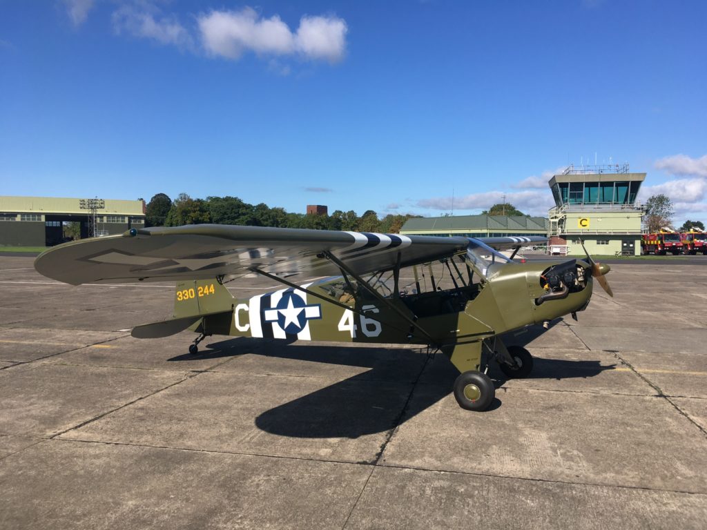
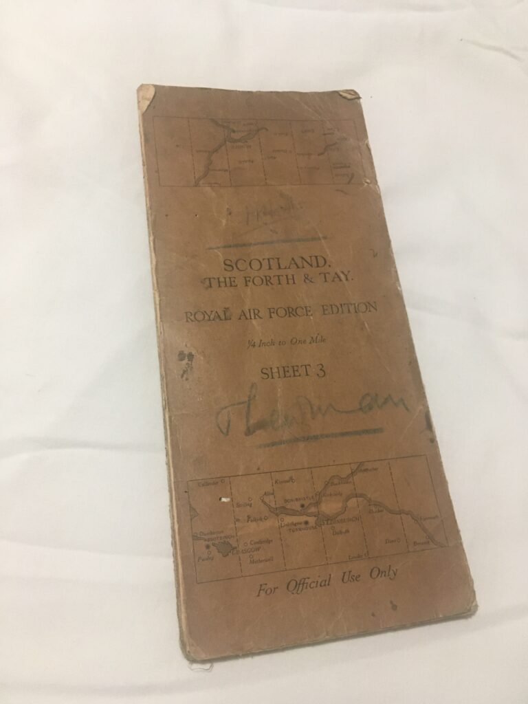
An interesting discovery at a local antique shop – an old RAF chart. Thanks to Helen for the find… her husband Darren works as a paramedic on the helicopter.

Its even of our own area! In good condition, there are some lines drawn on it in pencil so has been used for flight planning at least…

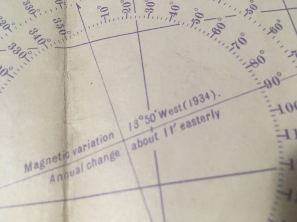
Searching for clues as to the map’s age, it says 1934 on the compass variation rose, although these are not usually changed every year, hence the “annual change” note:

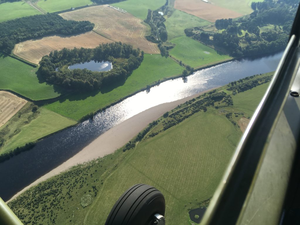
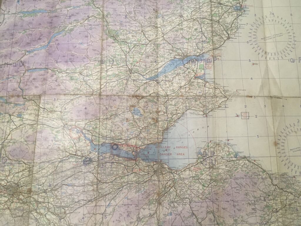
In those times the city of Glasgow was a lot smaller than it is today:

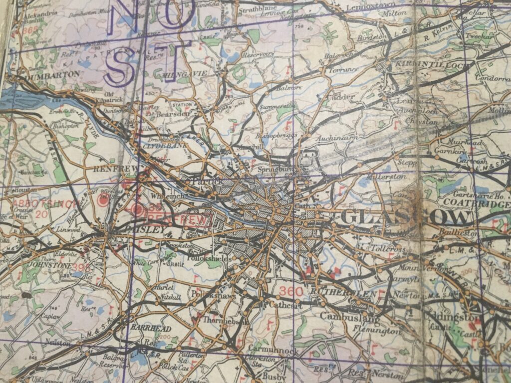
The red dots are airfields; Abbotsinch is now Glasgow Airport and Renfrew is now under houses and part of the M8 motorway. A closer look at the Dundee area provides a clue:

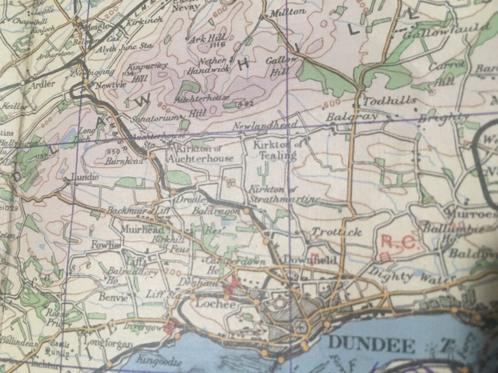
Our old friend Tealing airfield to the north of Dundee is not shown on the map, and looking at Fife Ness the airfield at Crail is missing too:

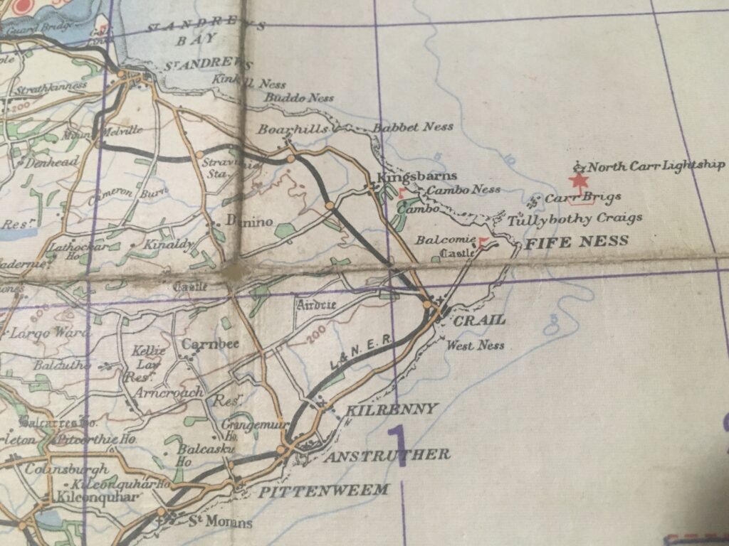
Tealing airfield was built during the early 1940s, during the massive expansion brought about by the Second World War. Crail was built in 1918 but deactivated after World War One then reactivated in 1939. So now we have narrowed the map’s age range to somewhere between 1934 and 1939.

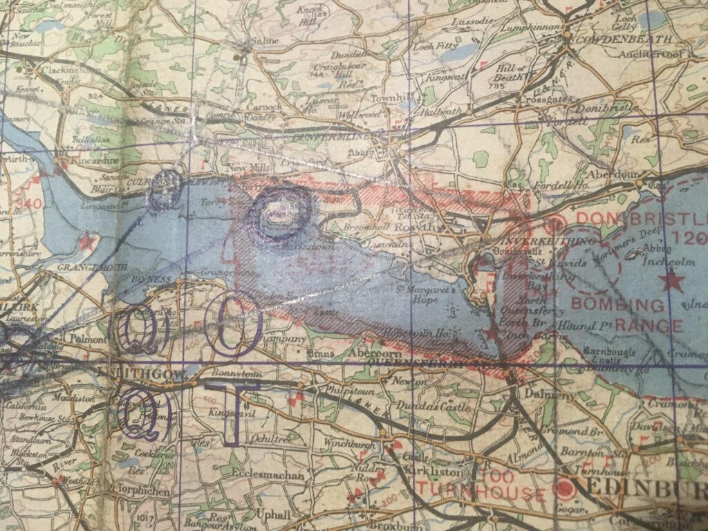
The Firth of Forth shows a large restricted area over the naval base at Rosyth, with a bombing range off Inverkeithing. The airfield at Turnhouse to the south of the Forth Bridge (it was the only bridge there at the time – no need to call it the Forth Rail Bridge) has now evolved into Edinburgh Airport. The old RAF Turnhouse has long been demolished to make way for the cargo apron and handling facilities…

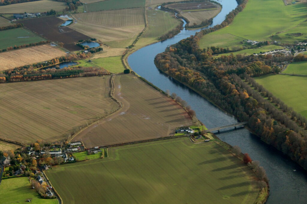
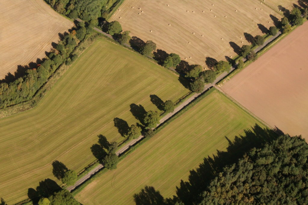
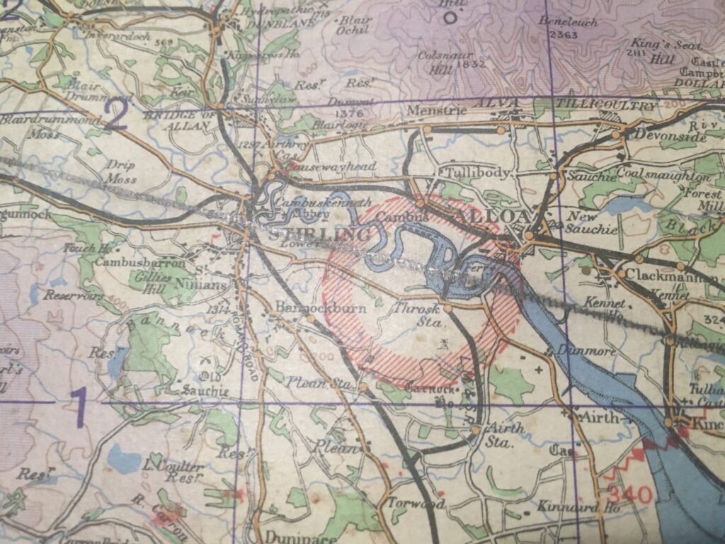
Not everything suffered the fate of RAF Turnhouse, there is still a lot of old military stuff dotted around the landscape. Our chart shows a restricted area in a bend of the Forth to the south of Alloa:

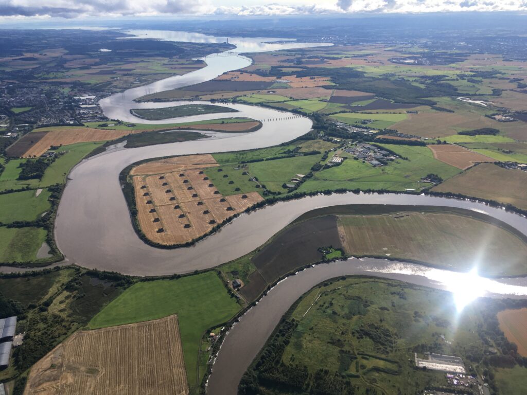
Here’s the same area today. The ammunition storage bunkers are still visible, revealing the reason for a restricted area. Don’t want any student pilots accidentally bombing the place…

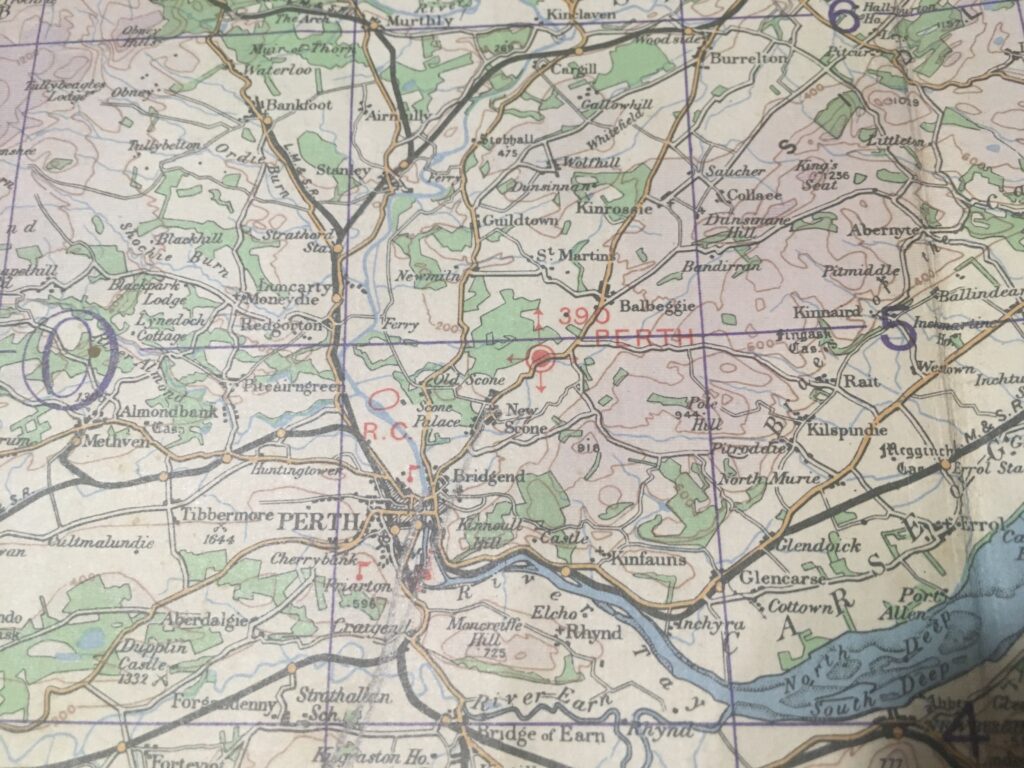
Our home base of Perth opened in 1936, so we have got it down to a three year period between ’36 and ’39 now. The airfield elevation is shown as 390ft above sea level. Nowadays it is published as 397 feet, so either the ground has risen 7 feet or surveying accuracy is better these days.

A close inspection of the notes around the edge of the map reveals the truth! In very small text is written:

AIR INFORMATION CORRECT TO NOTICE TO AIRMEN NUMBER [1937] 102

Interestingly the notes also state that obstructions are shown if they are over 200 feet (60 metres) above ground level – so metres were in use as a unit even then.

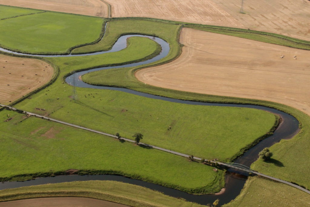
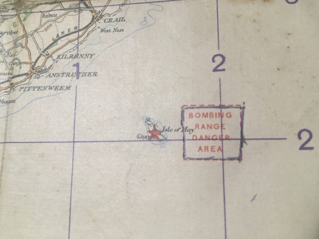
In 1937 there was a bombing range out at the Isle of May in the Forth:

Compare with 2021. Now 84 years later it is a bird sanctuary:

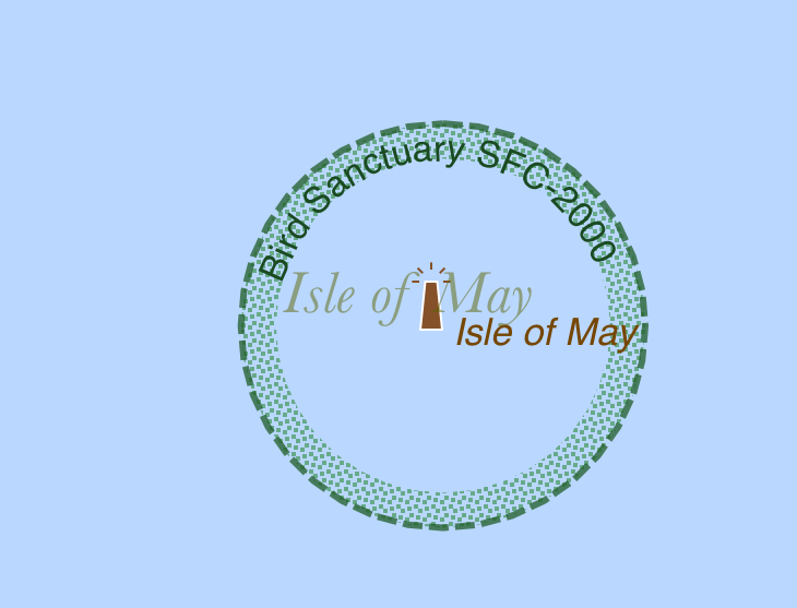
David Attenborough would approve!

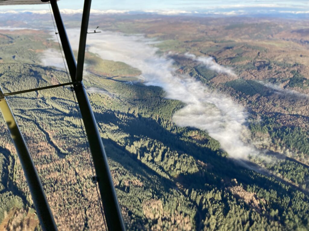
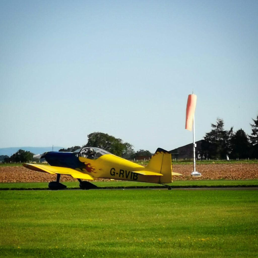
I’ve actually flown the Police helicopter in to the island, but that’s a story for another time…

Aerial Photo Dump

Some extra photos to make those massive subscription fees worthwhile. Remember you get what you pay for…

Whilst trying to draw the Christmas tree on Flightradar24, we had to climb quite high to ensure coverage. You’ll remember that it didn’t quite work out. Here are a few pics from way up high, to the north of the airfield:

And here’s one from slightly lower, on the way back in. The River Tay winding its way south towards Perth with its own ribbon of mist:

A couple of days previously the Tay was a little foggier. Here’s the whole valley filled up from Dalguise to Pitlochry, north of Dunkeld:

While down at Perth there was no fog at all. This is the tidal bit of the river, as it flows from right to left towards the Tay estuary and the North Sea. Maybe the saltiness of the tidal bit has an influence on fog formation…?

I like the rather cool shadows of the Friarton Bridge pillars. Low winter sun is great for long shadows:

Final photo, this was taken from the Cub on the Christmas Day flight. Before we joined up with Aaron in the Super Cub for the formation photos, I was looking down on these woods and wondering what the aircraft had been doing on Christmas Day 1944…had it been in the Battle of the Bulge in the Ardennes?

A little research uncovered that the US Army’s 79th Infantry Division, to which this aircraft 330244 was assigned, was in Alsace. They were holding a defensive line along the Lauter River, at Wissembourg. Probably with crappy weather. Luckily our weather was nice…

Christmas Cub Combo

A new Christmas tradition…I took the “World’s Coolest Copilot” flying in the Cub on the morning of 25 December. Just tootling around, enjoying the views and taking selfies (note my Christmas jumper!)…

…when who should pop up on the radio, none other than young Aaron, who was out and about in the Perth based Super Cub. Time for some impromptu formation flying! We joined up on the Super Cub and took a photo of him:

…while he took photos of us. Note the flaps down on the Super Cub so that we could keep up…Aaron said it could have been the world’s slowest formation!

We slid over to the other side for a different angle and more of the “you take photos of me and I’ll take photos of you” thing…

Note in the Super Cub the solo pilot sits in the front unlike the L4. Piper Aircraft removed the fuel tank in front of the cockpit and put the fuel up in the wings, which sorted out the centre of gravity issues. It means the Super Cub pilot can actually SEE the instruments, unlike me as my view was blocked by Rory in the front seat.

We stayed in formation all the way back to the airfield before splitting up for separate landings, us on runway 21 and Aaron on runway 27. The wind was all over the place and couldn’t decide which runway to blow down, so we used both.

Brenda snapped us as we flew over Wolfhill:

Back on the ground. You can see the family resemblance:

And thus a new tradition is born…Christmas morning Cub flight with the added bonus of some formation flying and photos thrown in.

It turned out quite nicely.

Unlike my attempt at drawing a Flightradar24 Christmas tree the day before using the RV6. I had just changed the oil, cleaned the fuselage, replaced a couple of tie-wraps and lubricated all the hinges so there was an excuse to go for a Christmas Eve flight.

The flight log on Skydemon shows the finished result:

…whereas the Flightradar24 trace is not so good. Over the hills FR24 reception can be poor and the 24th was no exception. It came out looking like a squirrel or an Easter Island stone head with something sticking out of his neck – definitely not a Christmas tree to be proud of.

Ah well, you can’t win them all. At least we had fun. Merry Christmas and Happy New Year to both my readers! Onwards to 2021…maybe the virus will let us fly further afield. Let’s hope.

Speed

This is the RV6 downhill from 8000ft with a hefty tailwind:

And it looks even better on Flightradar24, which usually has some innaccuracies thrown in…

Sometimes after tootling around in a Cub at 70 knots you get the urge to go fast. It should be called the “need for speed.”

Cool phrase. They should use it in a film.

50 Hour Inspection

The Cub was recently in with the engineers for a 50 hour inspection…

…so it was time to break out the RV6 and get airborne on a rather soggy day. We flew northeast from Perth and found a patch where the sun was trying to peek through:

Montrose Harbour:

After turning at Montrose I spotted this grass airstrip which I had never seen before. They are everywhere if you just look for them…

The patch of sunlight hadn’t moved too far when we passed it again:

Back towards the airfield, there was quite a bit of low cloud around:

Blairgowrie is under all that cloud…

A quick look at Blairgowrie and Rosemount Golf Club before heading back to base to land:

The next day, the Cub went from this:

To this:

So it was time to put some fuel in and go for a gentle cruise around the Perthshire countryside on a nice sunny day

The thing about the Cub is that unless you have a plan to actually get somewhere, it is very easy to just potter around the countryside using those huge windows to inspect anything interesting on the ground. Here’s the Skydemon trace of the flight:

We tootled around at about 1000ft looking at shapes and colours on the ground, occasionally circling back to get a better angle for a photograph. Here are some of the better ones:

Lovely autumn colours in the low sun:

The northern limit of our travels that day. Dunkeld – it’s only about 10 miles from Perth Airport:

The bridge over the River Tay at Caputh, taken on our way back towards the airfield:

On landing I had an email from the engineers with an invoice attached. As I like to say in justification – “It’s all part of being custodian of a piece of history.”

And it is worth it.

Cub Trip Across The USA

by Danny Linkous, guest contributor

Danny is the original builder of the replica P47 that I owned about 15 years ago, and we have kept in touch. He’s a former USAF F-4 Phantom pilot who moved to the airlines. Recently retired as a 767 Captain, he was still flying big jets as a delivery pilot for JetBlue before the downturn. He and wife Diane fly a Chipmunk from their home on an airpark in North Carolina.

A few weeks ago Danny got an offer he couldn’t refuse. He takes up the story:

About two weeks ago, I got a call from a guy who had just bought a 1940 Piper J-3C Cub.  The airplane was located at the Conroe, TX airport, just north of Houston.  The guy asked if I’d be interested in flying it to his home on an airpark about 15 miles north of where I live.  I decided to do it.  I mean, a flying job’s a flying job, right?

I plotted out a course on ForeFlight:

I packed everything I thought I would need, then took an American Airlines flight to Houston on the morning of the 19th.  I Uber-ed to the airport in Conroe. I inspected the plane, finding a couple things I was concerned about.  A visit by two very friendly mechanics put my mind at ease, so I rolled the airplane out to start it and check out the engine. I quickly rolled it back in the hangar as the weather had other plans…the sky opened up in typical Texas thunderstorm fashion:

About 90 minutes later, the weather had abated and I began my journey.  I was hoping to average about 65 knots.  Winds are predominantly southwesterly, but for some reason, I had a headwind every day.  My average ground speed was about 55 knots. But the weather was absolutely beautiful, so I counted my blessings and kept droning on to the northeast.

I was only able to fly one leg that first day, spending the night in Jasper, TX.  I met some very nice people there (and a couple of nice dogs), including Sully, a 4 month old Black Mouth Cur:

Departure was delayed on day two due to fog.  After it burned off, I launched and flew three legs, winding up in Jackson, Mississippi for the night.

I crossed the Mississippi River at Vicksburg, Mississippi:

Day three, I was able to fly four legs.  The weather remained beautiful.  The headwinds remained consistent.  But the flatlands I had been flying over were behind me and mountains, beautiful mountains, were now on the route.

I spent the last night of the trip in Cartersville, GA, just north of Atlanta.  My goal was to fly to Toccoa, GA leaving early the next morning.  I got to the airport before sunrise and prepared for what I hoped was the last day of the journey:

My original routing had to be modified because it was going to take me two+ hours to fly some of those longer legs (130 miles) with the ground speed I was getting.  Toccoa weather was good, so I launched to find my groundspeed was 45 knots and the ridges were obscured.  After flying about 20 miles, I diverted into Cherokee airport and waited for conditions to improve.  

After about a 90 minute delay, I took off again and was happy to see that my ground speed was now about 50-52 knots (I never thought I’d be happy about 52 knots of ground speed!).  A couple of fuel stops later and I delivered the airplane to its owner at Marchmont Airpark in Advance, NC.  His house is the last one on the right side of the runway:

It’s kind of ironic that about two weeks before the Cub trip I attended a 5-day JetBlue A320 recurrent training class.  I was re-qualified as an A320 captain and then put that training to use to fly a Piper Cub half way across the United States!  There is no JetBlue flying in my immediate future, unfortunately, but the company wants to keep the delivery group pilots qualified in case things turn around.

It was quite a little adventure, four days/12 legs/17.8 hours of flight time.

The Cub had a wind-driven alternator mounted between the landing gear struts.  It provided power to the cockpit mounted hand-held radio (the antenna mounted over the cockpit), a Garmin 396 GPS (which I didn’t use as I had my iPad with Foreflight installed) and a USB port to plug Apple devices into.  The electric system worked flawlessly during the whole trip.  

There was no starter.  Getting underway always included “flicking the screw”, as they say in the UK.  If anyone was around, I enlisted their help, either “flicking” or manning the mag switch while I “flicked”.  Several times I was alone, so I either chocked the airplane or tied the tail down and did a solo start.

Actually it was 13 legs, not 12.  I forgot to include the early morning divert leg in the total.  When I think that I flew only (only?!?) 13 legs and 17.8 hours of flying time, I think it just HAD to have been more than that.  There were times during the trip that it certainly FELT like I was doing more than that!

Would I do it again?  Well, of course!

Autumn Aerial Photos

More aerial photos from the Cub through the open window. An experiment with the longer lens. It does allow getting a lot closer to the action but even with a high shutter speed camera shake can be a problem, especially if the end of the lens is sticking out into the airflow. A lot of photos were discarded…these are some of the survivors:

More experimentation required. It looks like we’ll have to go flying again before it gets too cold to have the window open!

Three in One

Three aircraft in one day! That was the plan, we have to take advantage of good weather when we can. This is Scotland after all. First was a blast around in the RV6, over to Crianlarich, Rannoch Moor, Loch Tay, Glenshee and back to Perth… 1.3 hours.

Then we pulled the Cub out and refuelled:

Brenda’s first flight in the Cub was for 0.6hrs up to the strip at Kirriemuir, mostly at lowish level:

Enjoying the views:

At Kirriemuir we bumped into some of the RV gang who had been to Oban for lunch:

The Cub looks right at home on the grass. As well as Brenda’s first Cub flight it was my first grass landing in the aircraft. Got high and had to go around but the second attempt worked OK.

I tried to make the photo look old by filtering it on the computer, but it just looks like a monochrome modern picture:

On the way back to Perth (0.4hrs), Chris and Ian in the RV6A managed to snap this shot as they sped past:

I ran it through what I call the “olderizer” at http://labs.wnakoto.jp/olds – this fades it, monochromes it and adds a few blemishes as well. The result is much more realistic. Unless you notice the wind turbines in the background, but they could be smoke I suppose…

Finally a quick after-hours blast in the Eindecker Replica. 0.6hrs flown. (Photo by Wallace Shackleton as usual)

Just under 3 hours flown in 3 different aircraft in 1 day in glorious weather. A great day. Hoping for more days like this…maybe not with all three aircraft though, I was nackered!

Aerial Photography

Some shots from a recent flight in the Cub with the windows open. No captions, just patterns and shapes in the Strathmore countryside to the northeast of Perth:

The Cub is a great platform for photography, as you would expect from a military spotter plane. This one is more in keeping with the role – no enemy seen at the bridge:

I love the Cub, even though I am still frozen!

Life In The Slow Lane

It’s official.

I have just picked up India Yankee, the 1943 L4 Cub.

The aircraft was at Church Fenton/ Leeds East, and a bit of logistical planning was required. Brenda was bribed with the promise of a night in a hotel and the use of the car the next day to visit daughter Ellie and newborn Arthur, so I now had a lift down and the added bonus of space for any extras to come back.

After the formalities and with a full main tank and a full auxiliary tank it was time to set off northwards. I had planned a fuel stop at the halfway point – the delightful Northumbrian airfield of Eshott. It is a sign of the aircraft’s slow speed and the headwind on the day that Brenda was able to drive to Eshott and be there to meet me on landing. With snacks.

The route was north from Church Fenton, passing east of York and over the North York Moors to the coast at Redcar, then following the coast all the way past Hartlepool, Sunderland, South Shields, North Shields and Blyth before turning inland for Eshott.

The high wing and copious amounts of clear perspex make for good views, especially as I kept the height down as much as possible to get out of the teeth of the wind:

Cruising speed was 80mph, which is about 70 knots, and with a 30 knot headwind at times the groundspeed was down to 40. I could feel myself going grey. At one point passing Teeside I was convinced I was getting overtaken by an oil tanker on its way up the coast…

The wire fuel gauge seemed to go down really quickly, and I was thinking I would have to divert to Fishburn for fuel if I couldn’t transfer the auxiliary fuel from the wing tank into the main. Happily on opening the fuel valve the level in the wing went down and the wire in the main started to rise again until it was almost full. Loads of fuel! Panic over.

Eshott was windy, but straight down the runway so the landing was acceptable. I taxied up to the fuel truck and shut down one hour and fifty minutes after leaving Church Fenton. The airfield was quiet and it took some time to find a refueller but eventually the “almost empty” tanks took a grand total of 42 litres. Both tanks full is just under 80 so I had almost half the fuel left!

We took off again, the Cub and I, from Eshott and set course northwest. Now we were straight into wind and it took ages for the shadow to cross each field:

Eventually the coast of East Lothian crawled into view and we set off across the Firth of Forth towards Fife. Height by now was a little higher to give more options in the event of a problem. The auxiliary fuel transferred as advertised once again and endurance was no longer a concern.

Passing a rig off Kirkcaldy the wind shadow gives an idea of the strength of the wind:

Finally back over dry land at Leven. Onto the home stretch now…

Crossing the flat part in the middle of Fife near Ladybank:

And finally into the traffic pattern at Perth, an OK landing and taxied up to shut down at the work hangar, causing a bit of excitement:

Home at last…

After almost four hours of flying I wasn’t in the mood to wrestle the aircraft into its new spot in the aero club hangar, so we put it at the back of the work hangar. Total and utter coincidence that the “CUB” lettering is the right way up:

Next day I moved the aircraft into its new home, but not without going for a wee flight first:

Proving once again that it is a great little spotter plane. Awesome views from low level:

And finally into the new hangar spot. Eindecker and Cub back-to-back:

Sigurd Martin now stands for “Speed Machine” if it’s the RV6, or “Slow Machine” if it’s the Eindecker or Cub.

A couple of days later at work I rediscovered the excellent Mountain Weather Information Service website at http://www.mwis.org.uk – their simplified chart for the day of the ferry flight looked like this:

If I had seen the word “gale” before setting off I probably would have left the aircraft in the hangar!