First Flight Of March

Photo taken by the BMAA’s roving reporter Paul, who used to have a share in the Eindecker when it was based at Eshott in Northumbria. I was just about to get airborne for a quick local flight when he arrived at Perth in his shared Eurostar.

It looks as if there’s not much room – in fact I’m leaning in to monitor the engine instruments as the oil temperature warmed up. There’s loads of headroom.

The aircraft is a Sting, built from a kit manufactured by TL Ultralight in the Czech Republic. Pilot magazine’s flight test of a similar aircraft can be read at:

http://www.pilotweb.aero/features/flight-tests/ultralight_perfection_1_4157832


Caution: Naval Content

Just for Uncle Johnny…some warships on the Clyde.

This first one was making its way out of Faslane. Not sure if it’s an RN one or not. It had disappeared beneath the waves when we were on the return journey.

This next one is quite sad. This is HMS Ark Royal, which was decommissioned in 2011. I seem to remember this was her last visit to the Clyde before the end, which is why we went up specially to take photos.

Ark Royal from another angle, showing Merlin helicopters and Harriers arranged on the flight deck in an eye pleasing manner. Definitely a PR visit rather than operational.

Looking up Gareloch to HMNB Clyde, the submarine base more commonly known as Faslane. We’re not allowed any closer, as it has its own restricted airspace.

One of Faslane’s residents proceeds along the channel in the Clyde after departing Faslane (“Slipping and proceeding” in Navyspeak). Off to who knows where…

More soon…

Scottish Scenery

Just a few photos to keep us going during the winter months. No idea where this first one was taken…Perthshire somewhere I think.

This is looking north up Loch Lomond. There’s a nudist colony on the island in the foreground, allegedly

The bridge at Ballachulish, between Oban and Fort William…

The town of Rothesay on the Isle of Bute. The oval sports pitch on the left half way up is where we land the air ambulance helicopter to pick up patients for Glasgow.

…and finally, this is Helensburgh, on the northern shore of the Firth of Clyde. No need for a helicopter to get you to hospital from here, there’s a road

Skydemon Spaghetti

This is what it looks like on the Skydemon trace when you get airborne with no real purpose and just float about looking at things, also known as going for a “bimble” – it’s a very relaxing to spend an afternoon. No plan, no deadline, no pressure…

Obviously you don’t switch off totally, it’s bad form and considered ungentlemanly to bump into another aircraft, but as Richard Bach says “The sky is a great place to go and not think”.

Plus you get too see some cool sights…

Here’s the Blairgowrie and Rosemount Championship Golf Course (recently home to the Junior Ryder Cup). Or in aviation terms – a waste of a good grass airstrip.

This next one is Murthly. In the summer when the level of the Tay drops various sandbanks get exposed. We once landed the air ambulance helicopter on one to rescue a swimmer who was half drowned. Even got nominated for an award. Didn’t win.

And finally, Griffin Windfarm near Aberfeldy. Eagle eyed readers will notice that this couldn’t have been taken on the flight logged above. It was another from the works helicopter. These wind farms used to be quite good navigational features, but nowadays there are so many of them. We’re looking forward to flying across northern Germany, Denmark and Sweden where we’ll be able to see hundreds in one sweeping view…

Winter Flying

Cold, clear skies and an aircraft heater that works. Heaven. Some great views to be had during the winter. There are folk who put their aircraft away and tinker on it over the winter, preferring to fly when it’s warm and sunny. Obviously at work we fly all year round, and on days off if it’s not foggy, icy, snowing, windy or low cloud we also like to get airborne in the Sting.

Over the Ochill Hills looking towards Loch Leven and the Lomond Hills

Overhead Glenshee Ski Centre (spot the wing!)

Looking towards the Ochills from the south

Winter Aerial Sightseeing

And finally, it’s all very nice up there but it pays to keep a close eye on the weather. When a snow storm like this is bearing down on you, it’s time to head back to the barn.

Avionics Airtest

It’s done! The new Trig TY96 8.33 spacing radio has passed the airborne check with flying (ha) colours, so the aircraft is ready for the change in requirements coming at the end of 2017. The radio is excellent and has some really cool features including the play button to replay the last received transmission. Saves having to clutter up the airwaves with “say again?”

The paperwork has been sent off to Engineering at the Light Aviation Association and we’re waiting for the avionics approval to come back. The airtest also tested the transponder and altitude encoder so it involved heading down towards Edinburgh and getting help from ATC.

Trig Avionics is located in Edinburgh so it was good to support a local company and “shop local”

If it’s an avionics airtest then I must be a test pilot…right? Right?

(With apologies to Tom from my RAF Jet Provost course, who really IS a test pilot)

Happy New Year!

Happy New Year to my readers! Both of you. As a present, here’s a picture of Beith, southwest of Glasgow airport, half-in and half-out of winter fog.

beith-fog

…and on the Sigurd Martin / Sierra Mike front, we’ve just had the new 8.33 spacing radio fitted a whole 12 months before mandatory compliance. Just the airtest and paperwork to follow. If only the weather would oblige.

Aerial Geography Lessons

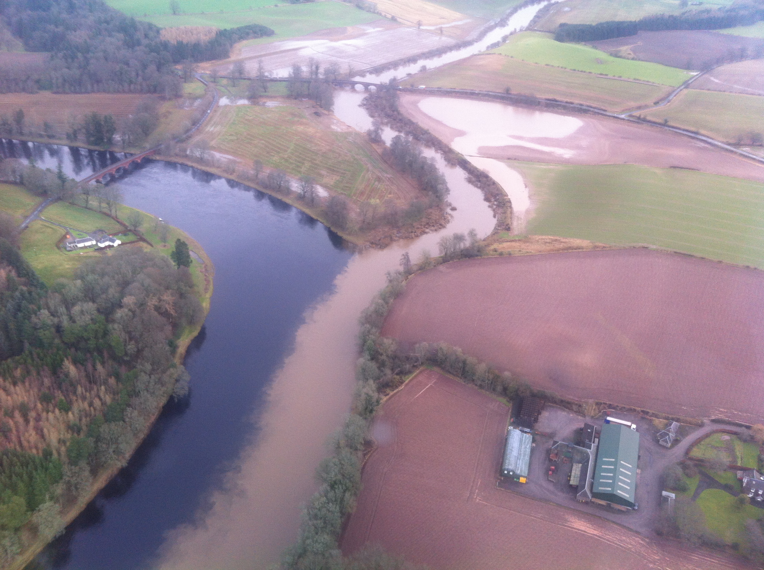
This is cool. It’s the River Isla joining the River Tay near Meikleour in Perthshire, taken after heavy rains and flooding in the Isla catchment area. The Isla is full of sediment and the Tay is clear. The distinctive two tone river continued for quite a way until the first shallow bit which mixed it all up. My friend Andy from Uni (now Professor of Physical Geography at Newcastle University) says the interface between the two flows of water shows nice Kelvin-Heimholz instabilities, but he always did talk dirty…

img_1865

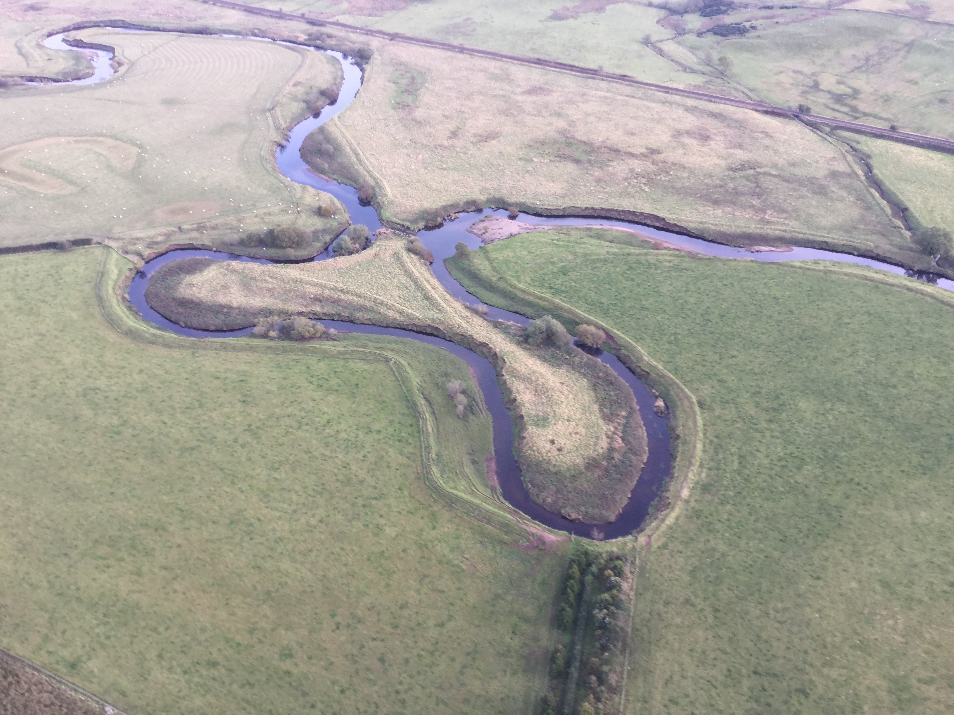
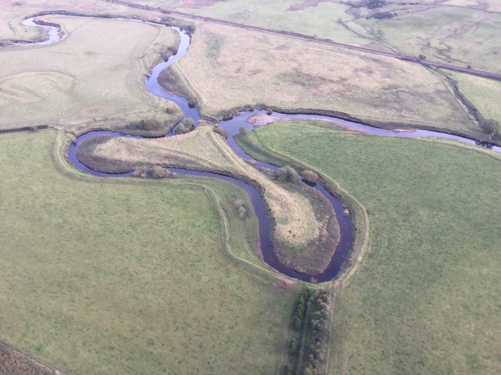
Everybody remember oxbow lakes from geography at skool? This is near the Balhaldie Services on the A9 between Dunblane and Gleneagles. The river flows from left to right and has broken through the neck. On closer inspection it almost looks too clinical, as if there has been a bit of man made encouragement, maybe a digger.

oxo

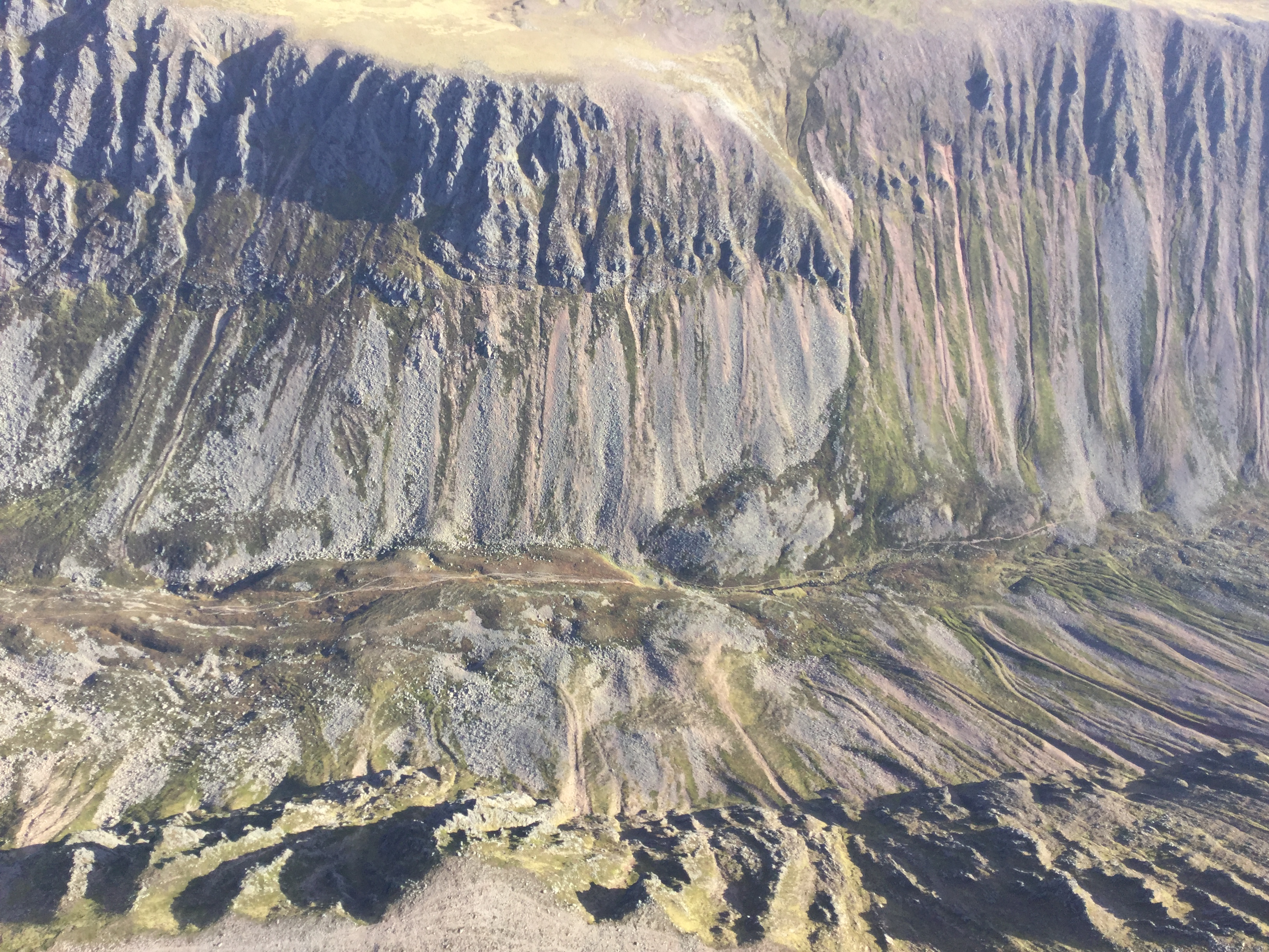
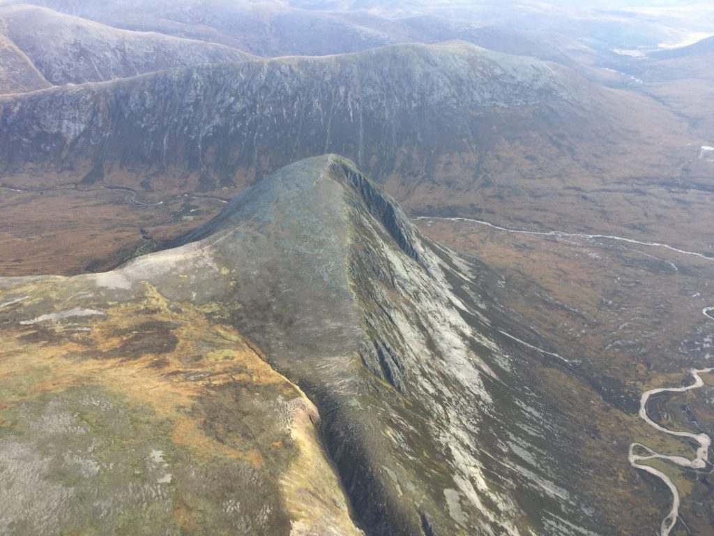
No digger for this one. This is the Lairig Ghru, one of the mountain passes in the Cairngorms. Gouged out by ice. Lots of ice…

gru

This almost vertical shot (iPad mini again) was from the works helicopter, not G-CESM. Next is Devils Point at the southern entrance to the Lairig Ghru

img_0550

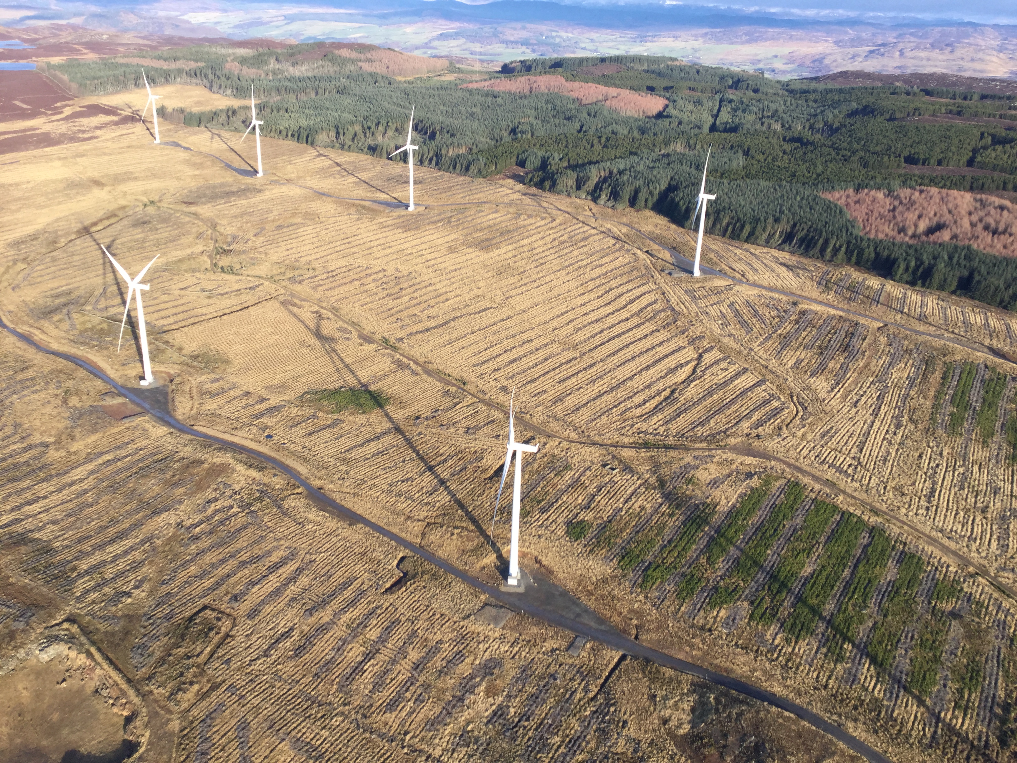
Here’s a random Scottish hill:

img_0563

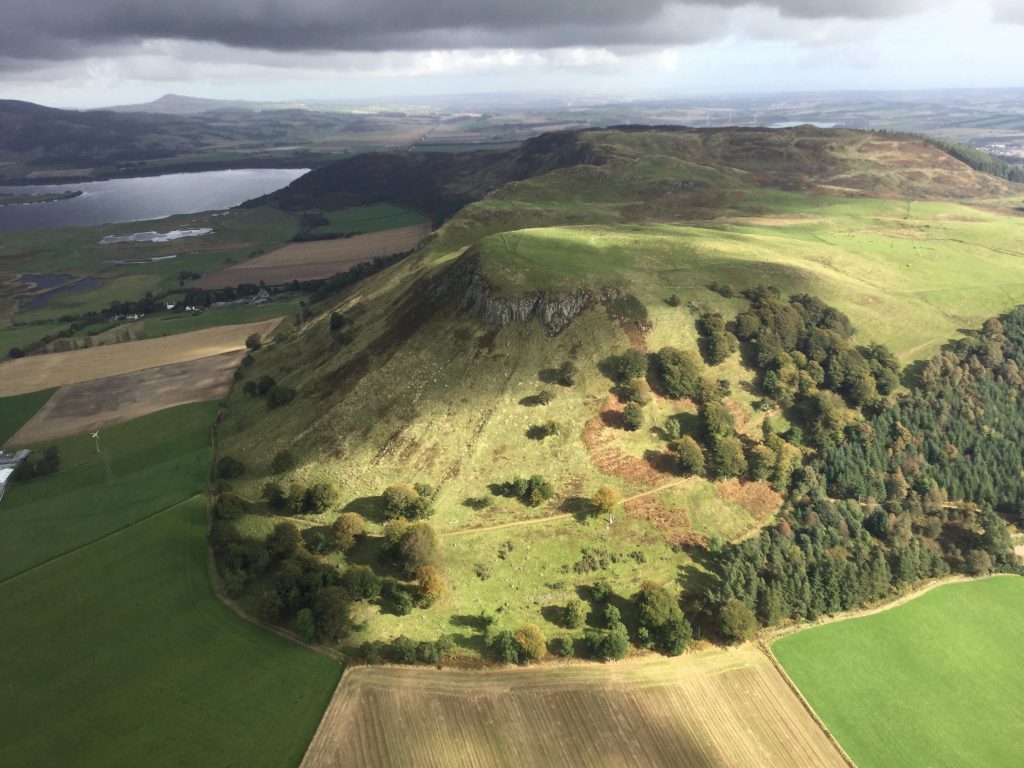
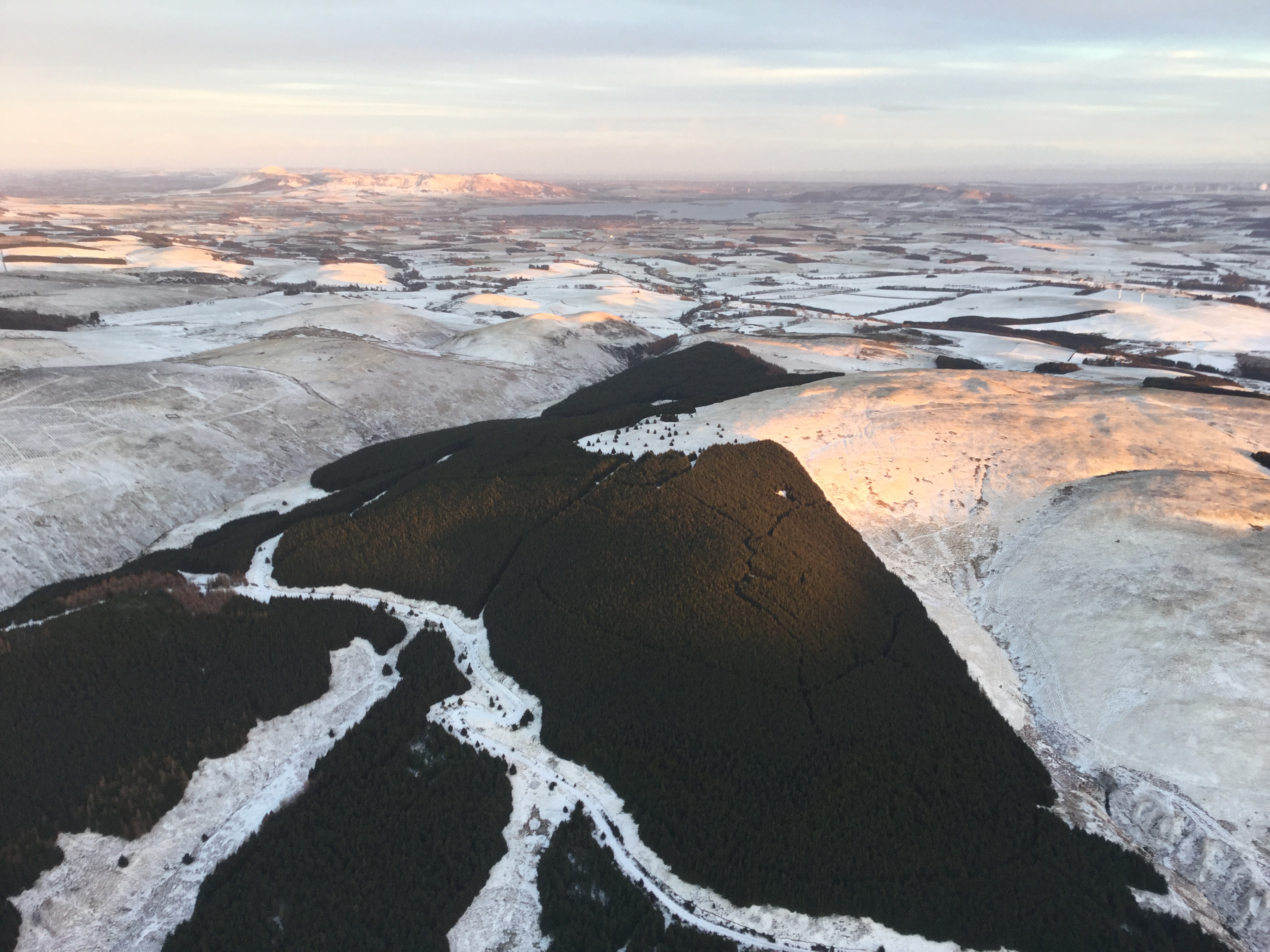
Regular drivers of the M90 might recognise the hill. It’s south of Kinross (the motorway was directly under the aircraft at this point). Loch Leven is in the background with Portmoak gliding airfield just beyond.

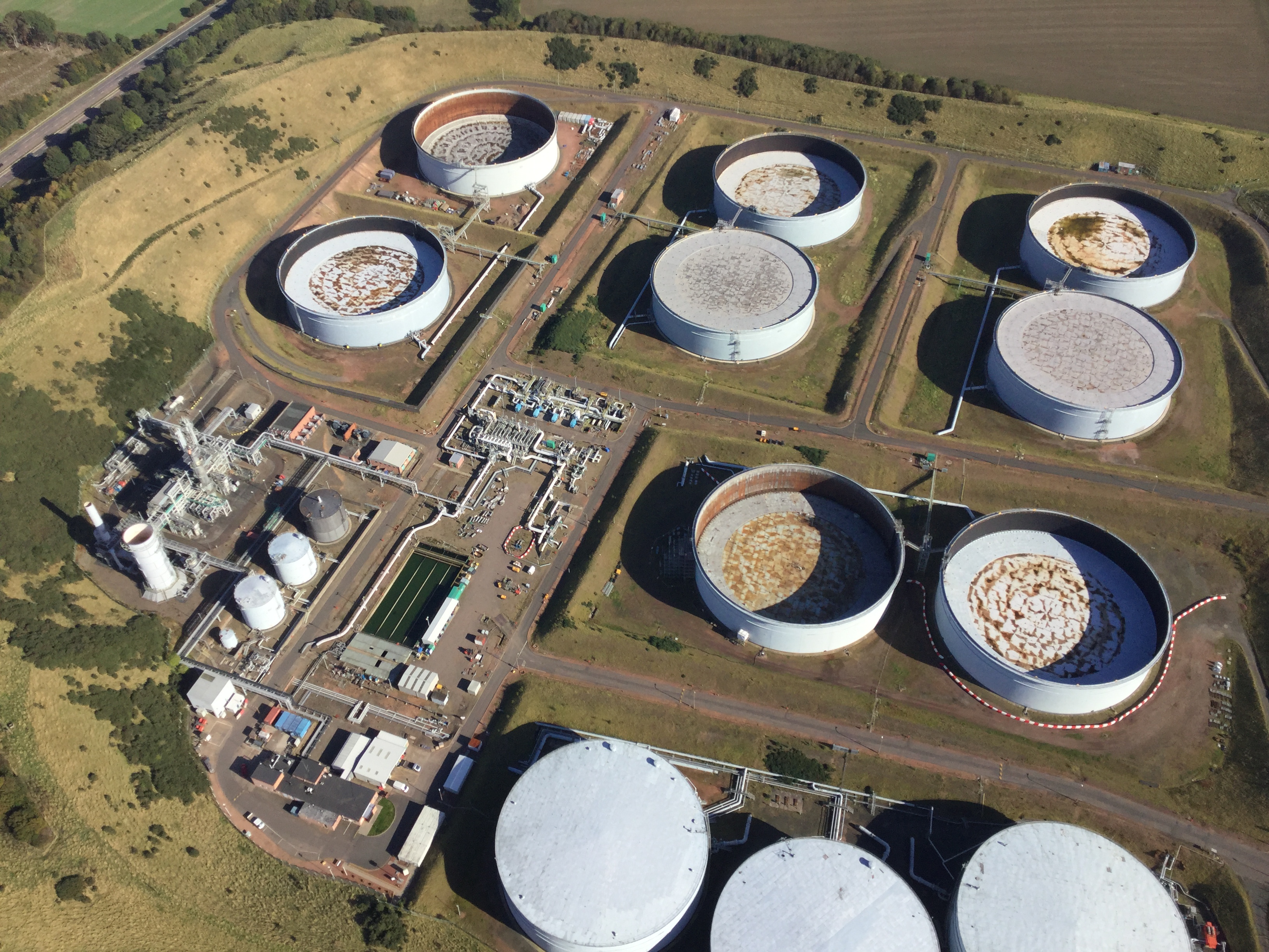
Despite what Professor Andy says, geography isn’t just landforms and erosion and Kelvin-Heimholz instabilities. This tank farm is part of the industrial geography landscape. Etc etc. I just like the picture…

img_0558

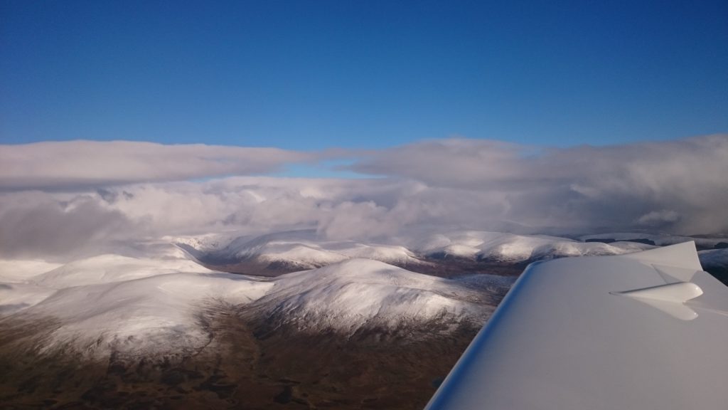
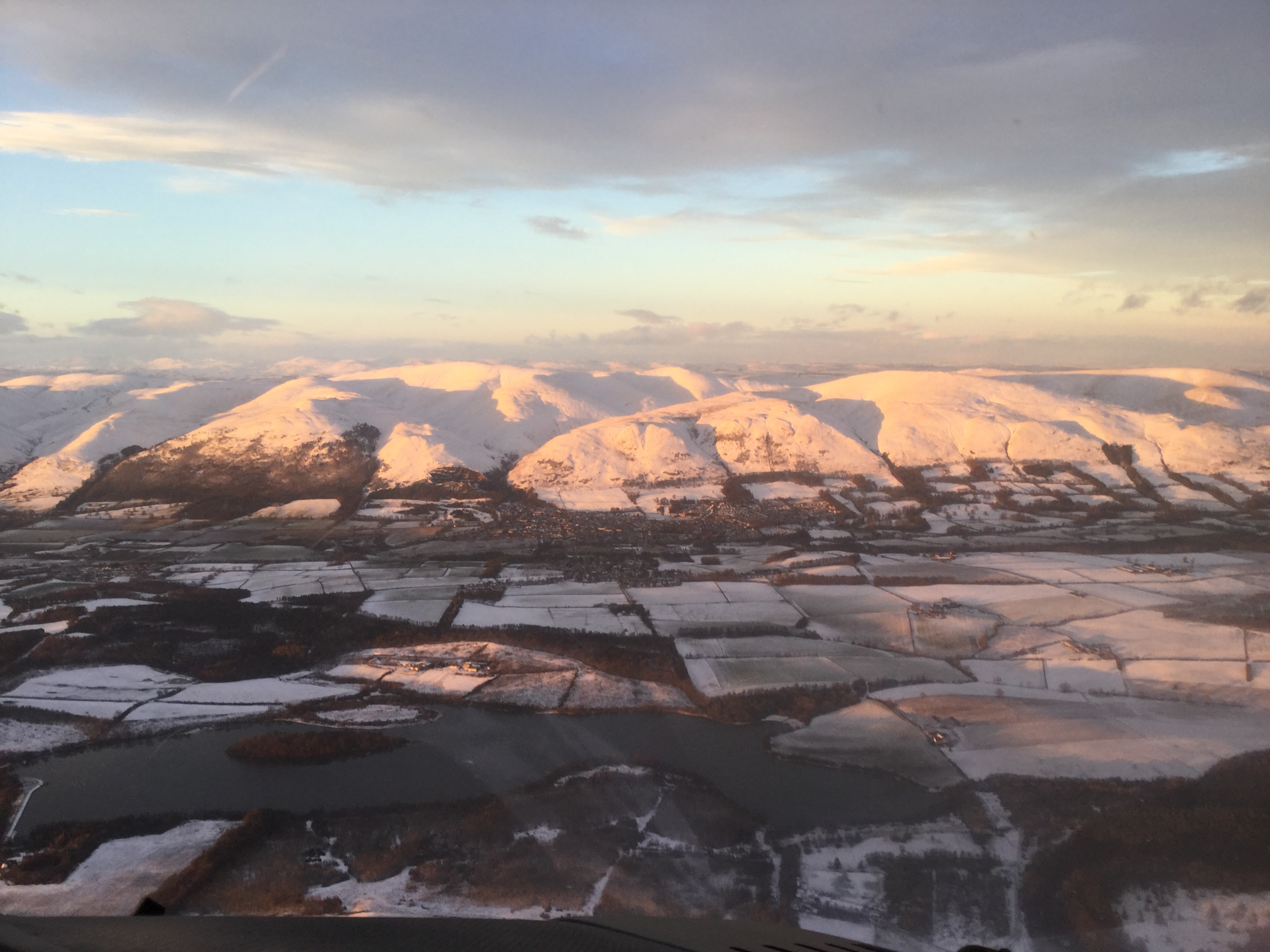
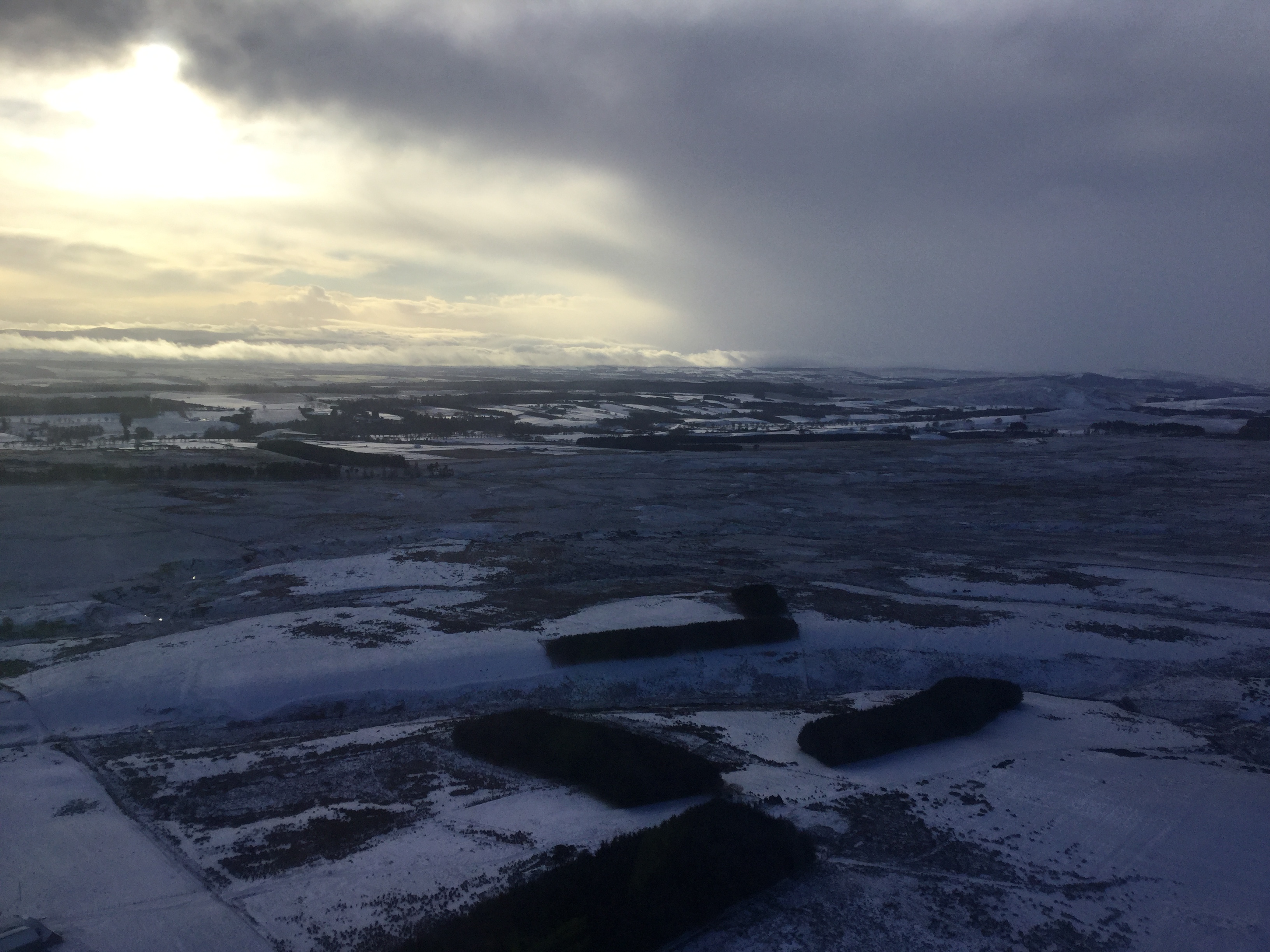
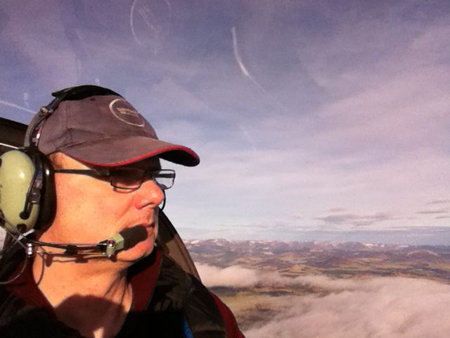
And finally, the snows have arrived and the ski centres are opening. We hopped in the Sting and with the excuse of needing to check out the heater, got airborne and headed north from Perth. Got to overhead the Glenshee Ski Area and then routed home via Pitlochry and Dunkeld. Sierra Mike / Sigurd Martin has now flown over 200hours (about 12 with me at the controls). The heater worked fine.

dsc_1357